UN
2 Adhurst Road
£ 300,000
Description
We don't have a Description for this property.
- Bedrooms
- 3
- Bathrooms
- 0
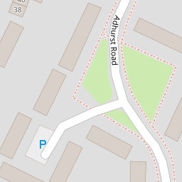

Leaflet © OpenStreetMap contributors
The heatmap indicates the level of crime in the area. The color of the heatmap indicates the crime severity and recency.
Metrics Year-on-Year
- Average area value
- 543,000.00 £Increased by 8.02 %
- Average area rental value
- 1,400.00 £/moDecreased by 23.75 %
- Est rental Yield
- 3.09 %Decreased by 29.45 %
- Crime Rate
- 9.00 %Unchanged by 0.00 %
from 502,673.00 £
from 1,836.00 £/mo
from 4.38 %
from 9.00 %
Nearby Schools
| Name | Type | Ofsted | Distance |
|---|---|---|---|
| St Alban'S Church Of England Aided Primary School | Voluntary Aided School | Good | 0.47 KM |
| Front Lawn Primary Academy | Academy Sponsor Led | Good | 0.72 KM |
| Trosnant Junior School | Community School | Good | 1.06 KM |
| Trosnant Infant School | Community School | Good | 1.06 KM |
| Trospacc Children'S Centre | Children's Centre | 1.06 KM |
Images
Nearby Streets
| Name | Average Price | Average Sqft | Distance |
|---|---|---|---|
| Juventu Close | £ 380,000 | 0 | 0.00 KM |
| Martin Road | £ 0 | 0 | 0.00 KM |
| Petersfield Road | £ 0 | 0 | 0.00 KM |
| Compton Close | £ 0 | 0 | 0.00 KM |
| New Road Roundabout | £ 330,000 | 0 | 0.00 KM |
Nearby Transport
| Name | NLC | TLC | Distance |
|---|---|---|---|
| Havant | 5532 | HAV | 1.14 KM |
| Warblington | 5264 | WBL | 1.60 KM |
| Bedhampton | 5538 | BDH | 2.32 KM |
| Rowlands Castle | 5658 | RLN | 3.85 KM |
| Emsworth | 5257 | EMS | 4.50 KM |
Nearby Listings
| Address | Price | Type | Score | Distance |
|---|---|---|---|---|
| Adhurst Road, West Leigh | £ 280,000 | BUY | 7 / 10 | 0.05 KM |
| Braishfield Road, West Leigh | £ 249,995 | BUY | 6 / 10 | 0.05 KM |
| Muccleshell Close, Havant, Hampshire, PO9 | £ 255,000 | BUY | 6 / 10 | 0.10 KM |
| Stockheath Way, Havant, Hampshire, PO9 | £ 270,000 | BUY | 7 / 10 | 0.14 KM |
| Muccleshell Close, West Leigh, Havant | £ 249,950 | BUY | 6 / 10 | 0.18 KM |
Nearby Properties
| Address | Price | Distance |
|---|---|---|
| 47 Adhurst Road | £ 152,500 | 0.00 KM |
| 5 Adhurst Road | £ 227,000 | 0.00 KM |
| 31 Adhurst Road | £ 250,000 | 0.00 KM |
| 27 Adhurst Road | £ 140,000 | 0.00 KM |
| 2 Adhurst Road | £ 300,000 | 0.00 KM |